


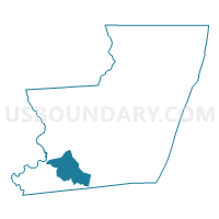
Worcester Precinct 04-001, Worcester County, Maryland
About
Outline

Summary
| Unique Area Identifier | 593280 |
| Name | Worcester Precinct 04-001 |
| County | Worcester County |
| State | Maryland |
| Area (square miles) | 23.88 |
| Land Area (square miles) | 23.82 |
| Water Area (square miles) | 0.06 |
| % of Land Area | 99.73 |
| % of Water Area | 0.27 |
| Latitude of the Internal Point | 38.06457650 |
| Longtitude of the Internal Point | -75.47459250 |
Maps


Graphs
Select a template below for downloading or customizing gragh for Worcester Precinct 04-001, Worcester County, Maryland


Neighbors
Neighoring Voting District (by Name) Neighboring Voting District on the Map
- Worcester Precinct 01-002, Worcester County, MD
- Worcester Precinct 01-003, Worcester County, MD
- Worcester Precinct 02-001, Worcester County, MD
Top 10 Neighboring County Subdivision (by Population) Neighboring County Subdivision on the Map
- District 2, Central, Worcester County, MD (7,112)
- District 1, Southern, Worcester County, MD (6,686)
- District 4, Western, Worcester County, MD (6,487)